As one of the leading geotechnical engineering companies in North East India, we specialize in Geotechnical Investigation, Pile Load Testing, Electrical Resistivity Testing (ERT), Pile Integrity Testing, and Structural Design, delivering precision, reliability, and innovation in every project we undertake.

Office Maps

Electrical Resistance Tomography

Geotechnical Engineering a solid foundation for every construction project.

Electrical Resistance Tomography

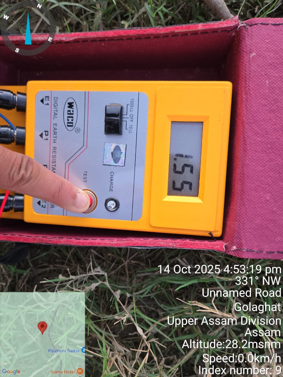
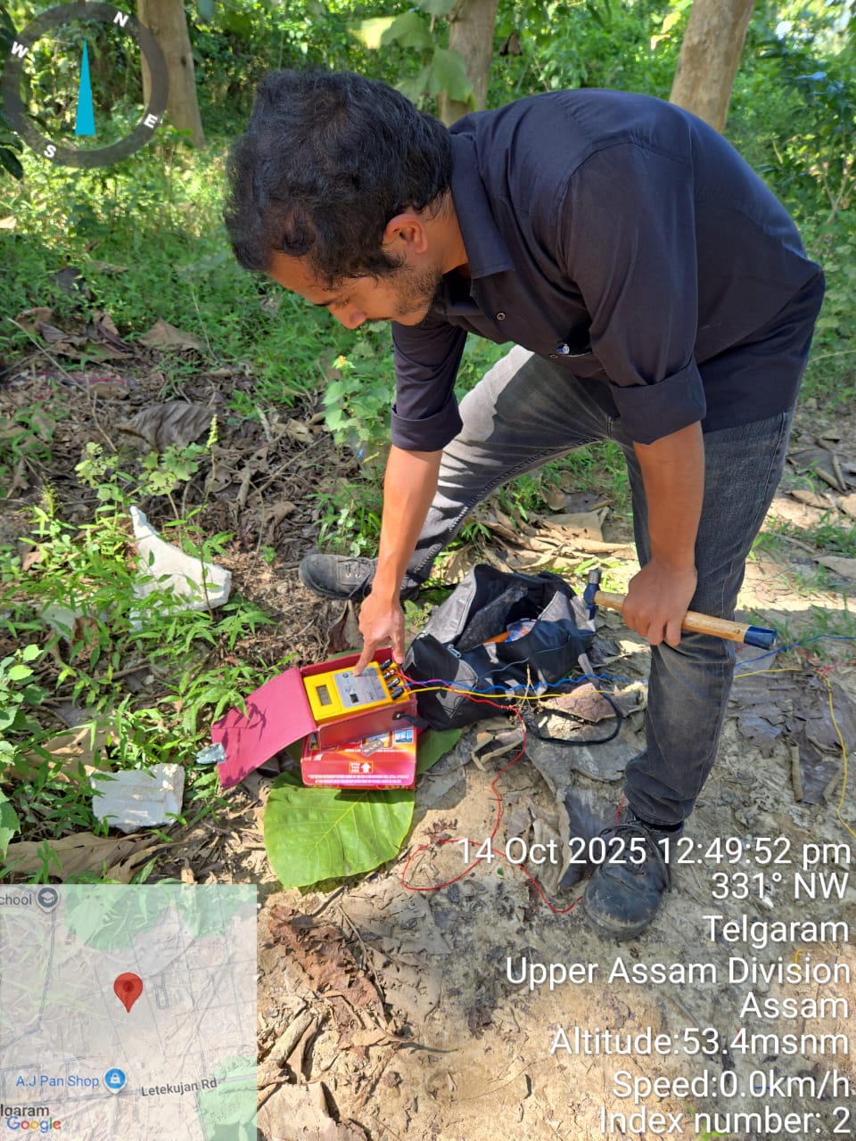
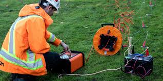
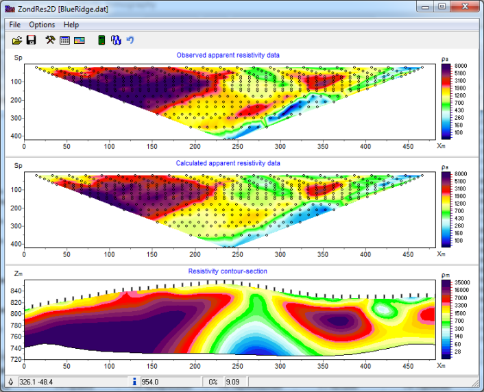
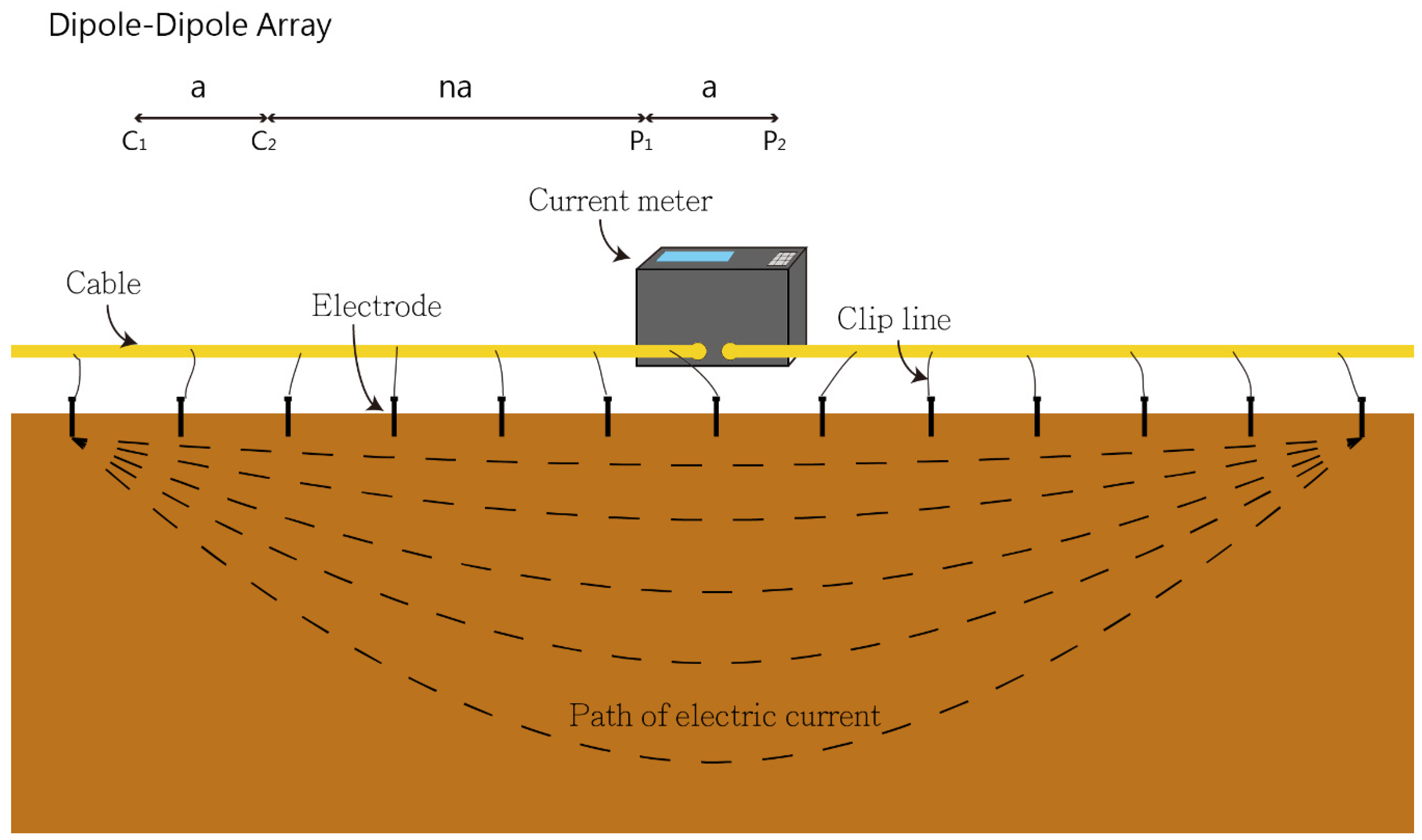
Electrical Resistance Tomography (ERT) is a non-invasive geophysical method used by B.S. ENGINEERING GEOTECH PRIVATE LIMITED to create 2D or 3D images of the subsurface. This technique helps us identify geological structures, groundwater contamination, and the location of underground utilities without the need for extensive excavation. It provides a detailed, real-time look at what lies beneath the surface, making it an invaluable tool for site characterization and environmental monitoring.

Our Integrated Process for Your Construction Project

Our process is meticulously designed to support every phase of your construction project, from initial planning to final execution. We start with a detailed consultation to understand your specific needs, followed by a thorough site assessment. This allows us to develop a comprehensive, tailored plan that seamlessly integrates with your overall construction timeline, ensuring a smooth and efficient build.

  • Initial Consultation & Project Assessment: We work with you to define project goals and requirements.
  • Comprehensive Site Analysis: Our team conducts in-depth soil, material, and site investigations.
  • Detailed Planning & Design: We create precise, engineering-driven plans that meet all project specifications.
  • Regulatory & Permitting Support: We assist in securing necessary approvals to keep your project on track.
  • On-Site Execution & Oversight: Our experts provide continuous support, ensuring quality and safety standards are met.
  • Final Reporting & Project Completion: We deliver detailed reports and ensure a successful project handoff.

Benefits for Your Construction Project

At B.S. ENGINEERING GEOTECH PRIVATE LIMITED, we are a leading geotechnical firm whose core mission is to empower the construction industry. Our expertise goes beyond soil analysis; we provide the critical data and support that building professionals need to construct safe, durable, and cost-effective structures. We partner with you to mitigate risks, optimize designs, and ensure the long-term integrity of your investment.

  • Risk Mitigation: Our thorough investigations identify potential issues before they become costly problems.
  • Structural Integrity: We provide the data required to design foundations that are safe and reliable.
  • Cost Optimization: Accurate geotechnical data can prevent over-engineering and lead to significant cost savings.
  • Regulatory Compliance: Our reports and plans help you meet local building codes and standards.
  • Project Efficiency: Our services streamline the planning phase, preventing delays in your construction timeline.
  • Long-Term Durability: We ensure your structures are built on a solid foundation that will last for decades.

Frequently Asked Questions

ERT is a geophysical imaging technique that uses electrical currents to map the distribution of electrical resistivity in the subsurface. By measuring how the ground resists an electrical current, we can infer the composition and condition of the soil and rock.

ERT has a wide range of applications, including locating and mapping subsurface geology, detecting groundwater contamination plumes, finding buried utilities or archaeological sites, and monitoring landslide-prone areas. It is an excellent tool for environmental and geotechnical assessments.

Yes, ERT is completely non-destructive. It involves placing a series of electrodes on the ground surface, so there is no need for digging or disturbing the site, making it ideal for sensitive environments.

ERT provides a detailed cross-sectional or 3D model of the subsurface, showing variations in resistivity. These images help us identify different soil layers, bedrock depth, water-saturated zones, and the presence of any anomalies.